Portfolio
Denise Wright
Certified GIS professional (GISP) and FAA-licensed UAS operator with a strong background in geospatial technologies and remote sensing. Experienced in GPS field data collection, LiDAR point cloud classification, extraction, and animations, 360 imagery, and ESRI products including desktop as well as web applications.
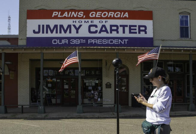
Jimmy Carter National Historical Park - Digital Preservation
This collaborative effort involved creating 3D models and virtual tours to commemorate the craftsmanship and legacy of President Jimmy Carter. Using photogrammetry and advanced 3D modeling techniques, the team (USF CDHGI) digitized artifacts and architectural elements to preserve their historical significance and enhance accessibility. The models were embed into an interactive virtual tour, enabling virtual tourism that highlights Carter’s impact and cultural heritage.
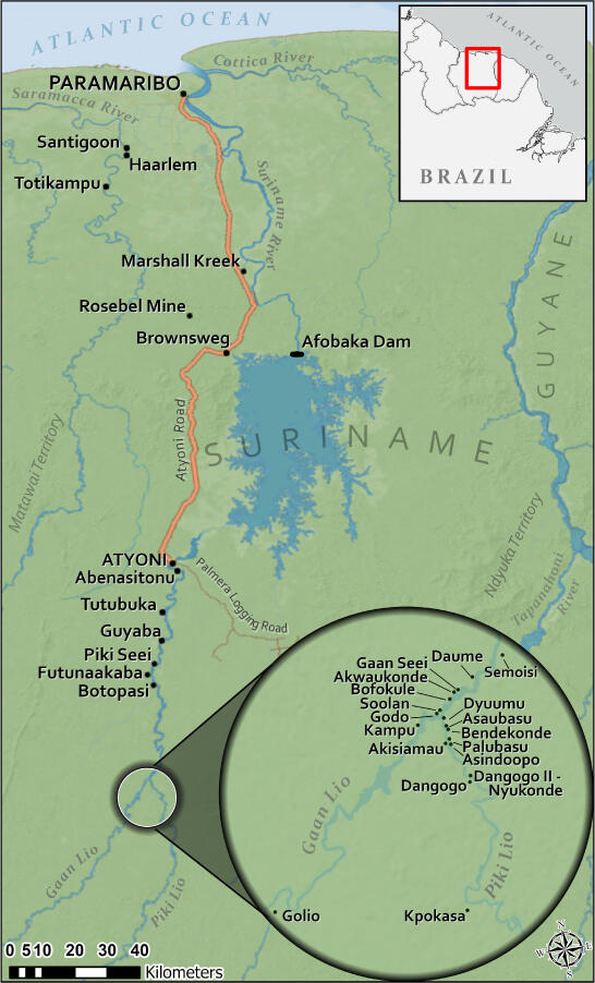
Map for Peer Reviewed Journal Article
Map created to client specifications for New West Indian Guide "Rip Van Winkle in the Rainforest" by Richard Price and Sally Price. The article reports on a visit by two anthropologists to the Upper River Saamaka area in Suriname after a 45-year absence. They observed significant changes in various aspects of village life, including transportation, communication, education, agriculture, and ritual practices. The article also discusses the impact of illegal logging and central government encroachment on the Saamaka community.
see footnote 1 for map credits
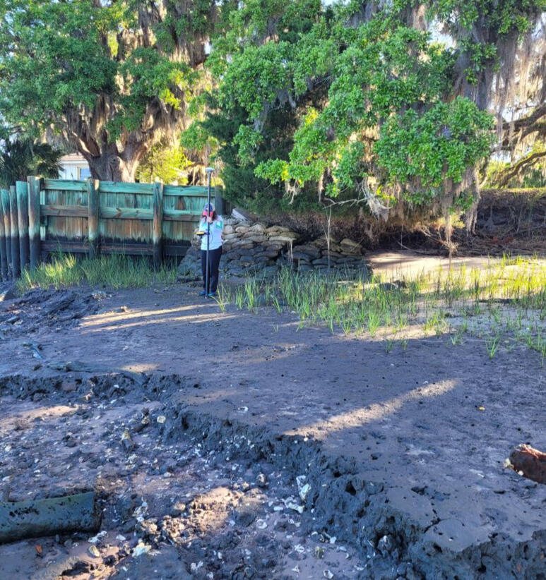
Measuring Shoreline Change - Graduate Project
My project aims to use remotely sensed data to determine shoreline changes and help monitor at-risk historic structures impacted by coastal erosion at the Plum Orchard site in Cumberland Island, Georgia. Objectives are to use GIS Data, GPS Data, and remote sensing to analyze shoreline changes to help determine historic structures impacted by erosion.
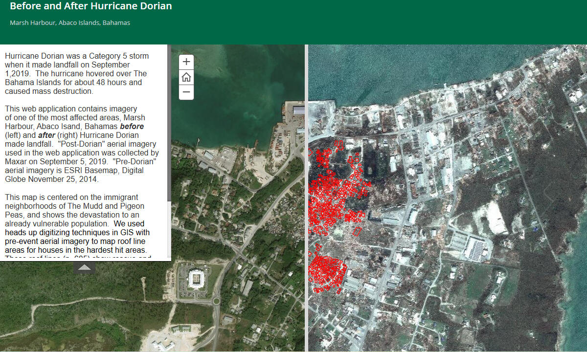
Hurricane Dorian Relief Efforts
By data mining and analyzing pre- and post-storm satellite imagery, myself and a student researcher identified the original locations of impoverished homes in the Pigeon Peas and Mudd areas now destroyed by Hurricane Dorian. An ArcGIS Online Web Application was creating using the data to show the catastrophic damage. While full reconstruction of the Bahamas may take years, this technological approach provides a clearer starting point for recovery teams.
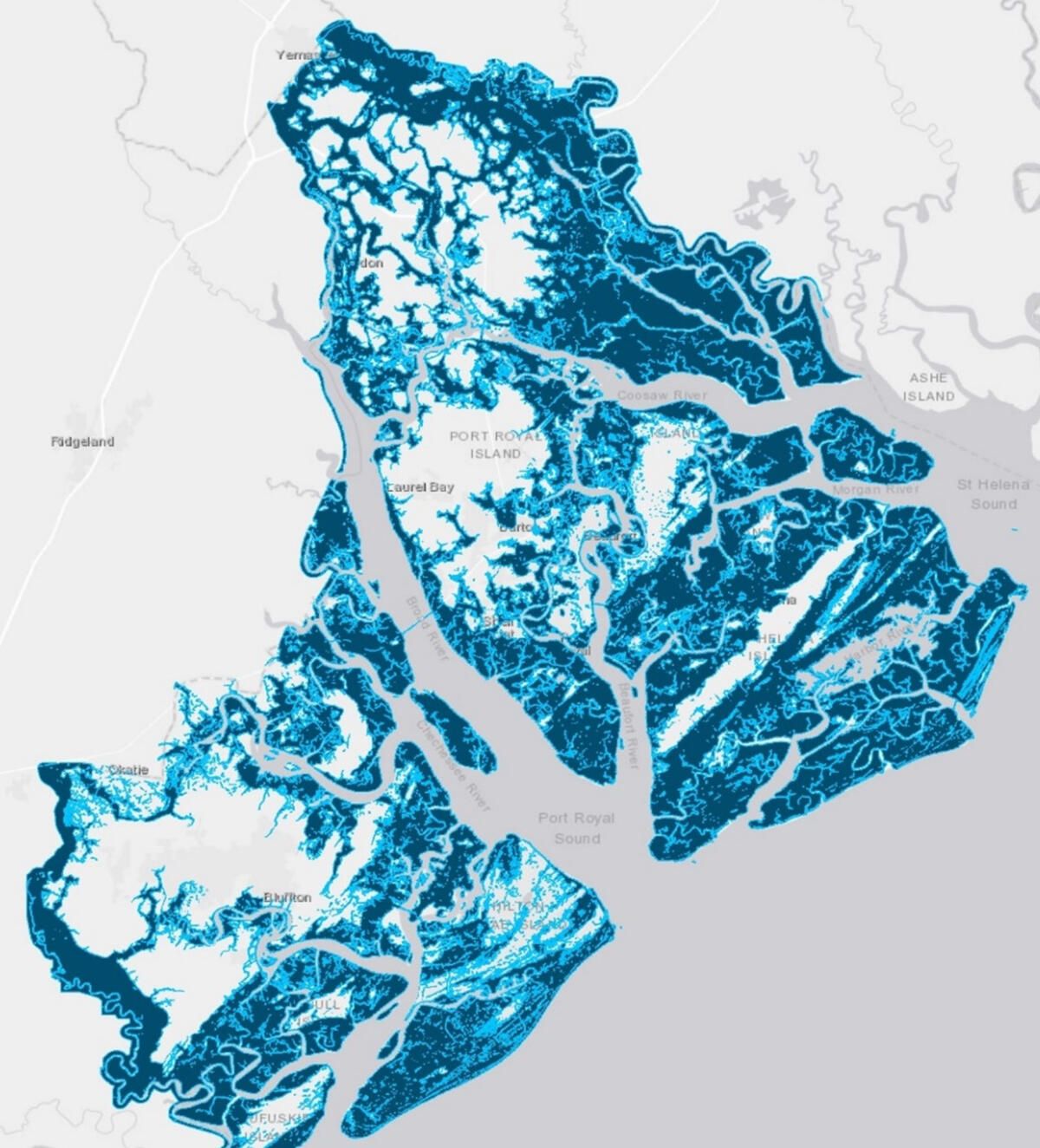
Sea Rise StoryMap and Report
The marsh barrier islands of Beaufort County, South Carolina, are highly vulnerable to climate change, rising sea levels, and hurricanes, a risk exemplified by the Great Sea Island Hurricane of 1893. The devastating storm brought a 10-12 foot storm surge, causing over 2,000 casualties, primarily among isolated African American communities with limited communication and resources. It marked one of the first major hurricane relief efforts by the American Red Cross. Using ArcGIS Desktop and Model Builder, a model was created that replicates the storm surge to assess modern coastal resilience and whether advances in technology and preparedness have reduced vulnerability over the past 120 years.
Interested in learning more?
Please view my resume and LinkedIn profile, or reach out through email if you'd like to set up a virtual meeting!